|
Picture |
Bridge's Common Name |
Year Built |
Creek | Arch Number | Size | Builder | 2008 Traffic | GPS | Location | Regis-tered | ||||||||||||
| (Click On photo to enlarge) | ||||||||||||||||||||||
 |
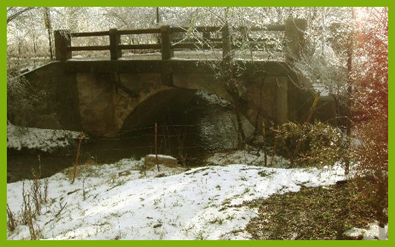
Badger Creek Bridge | 1900 | Badger | 1 Arch | 14.1'- Deck 78.0'- Length | Unknown | 15 | 37o11'45"N 96o55'59"W | 196th Rd SE Winfield | x | ||||||||||||
 |
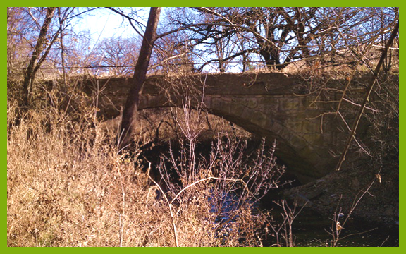
Poor Farm Bridge | 1910 | Black Crook | 1 Arch | 20.0'- Deck 38.0'- Length | Unknown | 75 | 37o13'28"N 96o58'22"W | Joel Mack Rd So Winfield | x | ||||||||||||
 |
Crab Creek Bridge | 1900 | Crab Creek | 1 Arch | 14.1'- Deck 57.0'- Length | Unknown | 10 | 37o08'28"N 96o44'42"W | Crab Creek Rd- SW Dexter | x | ||||||||||||
 |
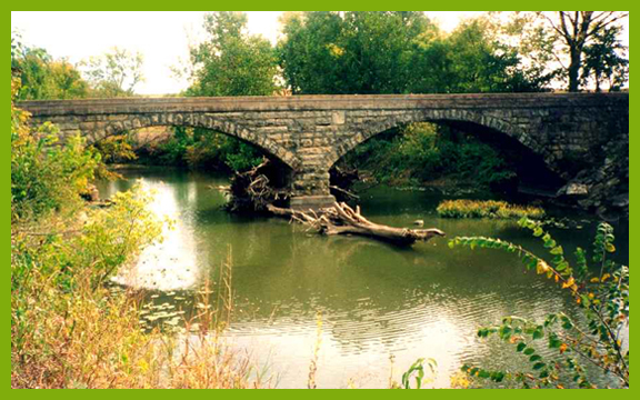
Rock Creek | 1910 | Rock Creek | 2 Arches | 13.8" Deck 130.9' Length | Unknown | 25 | 37o26'50"N 96o58'30"W | 2 Mi East Rock | x | ||||||||||||
 |
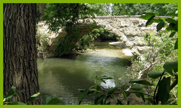
Stewart Bridge |
1904 |
Stewart Creek | 1 Arch | 14.4'- Deck 83.0'-Length | Hammon Contractor & Builder | 10 | 37o2306"N 97o03'38"W | (E of Udall) So off K15 on 51st Rd | x | ||||||||||||
 |
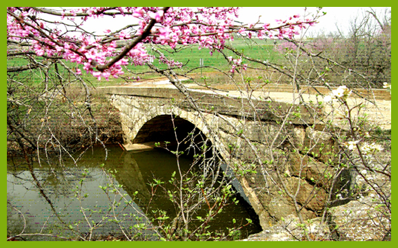
Martin Bridge (Colglazier or Means) | 1920 | Bullington Creek | 1 Arch | 20.0'-Deck 27.9'-Length | Unknown | x | 37o11'05"N 96o42'55" | 1 mi So Cowley 28 on Grouse Creek Rd | x | ||||||||||||
 |
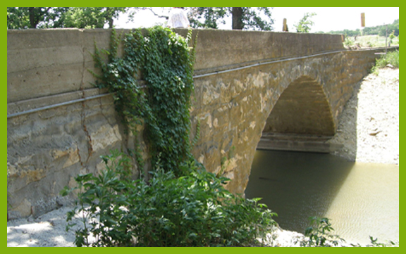
Spring Creek Tributary | 1925 | Spring Creek Tributary | 1 Arch (Concrete) | 21.0'-Deck 90.9' Length | Unknown | 100 | 37o06'00"N 97o05'06"W | 122W on Skyline Rd Eof 31st NW Ark City | x | ||||||||||||
| (Photo not yet Available) | Bucher Bridge | 1905 | Eightmile Creek | Walter Sharp | 10 | 37o27'45"N 97o02'20"W | 4miW, 3N, 1 1/4 E of Rock | National Register | ||||||||||||||
 |
Timber Creek Bridge | 1908 | Timber Creek | 1 Arch (Gone?) | 14.1'-Deck 60.1'- Length | Unknown | 5 | 37o18'10"N 96o57'24"W | On 122 Rd off of 101Rd- North on College to 111Rd, then to 122, Then W | x | ||||||||||||
 |
Elrod Bridge | 1915 | Timber Creek | 1 Arch | 15.7'-Deck 74.2'- Length | Unknown | 10 | 37o24'58"N 96o43'52"W | C46 Rd N of Baltimore on 231st Rd (SE Atlanta) | x | ||||||||||||
 |
Floral Bridge | 1906 | Timber Creek | 1 Arch | 14.1'-Deck 60.1'- Length | Walter Sharp Co | 50 | 37o20'46" N 96o54'59"W | So. Floral or NW New Salem | x | ||||||||||||
 |
Fromm Bridge | 1917 | Grouse Creek | 1 Arch (2nd filled) | 14.1'- Deck 117.1'-Length | Walter Sharp Co | 15 | 37o22'36"N 96o39'07"N | 4 Mi N. Cambridge | x | ||||||||||||
 |
Neer Bridge | 1910 | Grouse Creek | 2 Arches | 13.5'-Deck 106.0'-Length | Unknown | 15 | 37o23'25"N 96o38'42"W | 5 mi N. Cambridge | x | ||||||||||||
 |
Fox Bridge (or Howe, or Ellis) | 1910 | 5 mi N. Cambridge | 1 Arch | 12.1'- Deck 113.8'-Length | Unknown | 10 | 37o23'53"N 96o37'55"W | 6 mi N. 2 E of Cambridge | x | ||||||||||||
 |
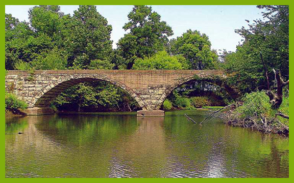
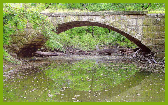
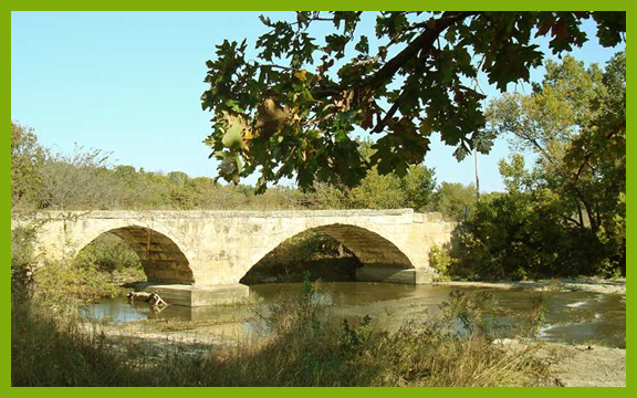
Pudden Bridge | 1890 | Grouse Creek | 3 Arches | 13.1'- Deck 182.1'-Length | Unknown | 25 | 37o08'08"N 96o46'53"W | 232 Rd So Dexter off Grouse Creek Rd | National Register | ||||||||||||
 |
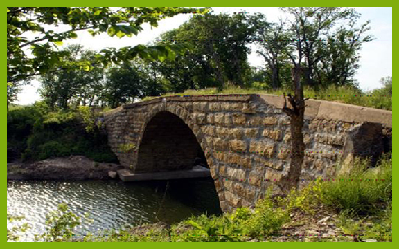
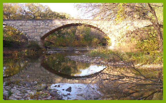
Andes (or Yadon) (or Old Silver Creek Swimming Hole Bridge) | 1890 | Silver Creek | 2 unequal Arches | 14.1'-Deck 143.0'-Length | Walter Sharp Co | 15 | 37o12'04"N 96o50'36"W | 3 So US160, 2 E Cowley1 | National Register | ||||||||||||
 |
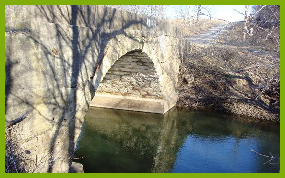
Muret (Hart) Bridge |
1890 |
Silver Creek | 1 Arch | 14.1'- Deck 96.1'-Length | Walter Sharp Co | 25 | 37o08'33N 96o51'56"W | 5 So Us160, 1 E Cowley1 | x | ||||||||||||
| (Picture Not Yet Available) | Stalter |
Unknown |
||||||||||||||||||||
|
Cowley
County, The Stone Arch Capital of KS (and possibly the United States) |
||||||||||||||||||||||
|
||||||||||||||||||||||